



ShipFinder provides real-time vessel tracking on an interactive map. Search by vessel name, IMO number or MMSI to check the current position, destination and estimated time of arrival. With historical tracks, event alerts and fleet management, you can follow a single vessel or keep track of several ships relevant to your work.
Search for a Ship by Name, IMO Number or MMSI
Find the Right Vessel
Enter a vessels name, IMO number or MMSI in the ShipFinder search bar, then select the matching result.
When several ships have similar names, compare their IMO numbers or MMSIs before following their movements. If you are tracking a vessel connected to a shipment, confirm the current vessel assignment with your carrier or freight forwarder.
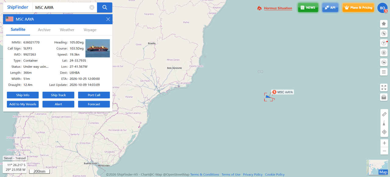
Review Vessel Details
Confirm you have selected the correct ship, then review its position and voyage details to follow its progress.
Vessel identity: Name, IMO number, MMSI and call sign.
Type and dimensions: Vessel type, length and width.
Latest reported movement: Position, report time, speed and course.
Voyage information: Destination, ETA and draught.
Track Vessel Positions and Voyage Progress
Check the Latest Position and Report Time
Start with the vessel's latest reported position and its timestamp. Then review its speed over ground and course over ground to understand how it was moving at the time of the report.
Read these fields together:
Position: Where the vessel was reported.
Report time: When that position was recorded.
Speed and course: How fast it was moving and in which direction.
Review Destination and ETA
Check the reported destination and estimated time of arrival to follow voyage progress. Compare them with the port or voyage information relevant to your work.
An ETA is an estimate of vessel arrival. For cargo-related monitoring, it should be considered alongside the carrier's schedule; it does not establish when cargo will be discharged or ready for collection.
Follow Vessels Beyond Coastal Coverage
Terrestrial and Satellite AIS Tracking
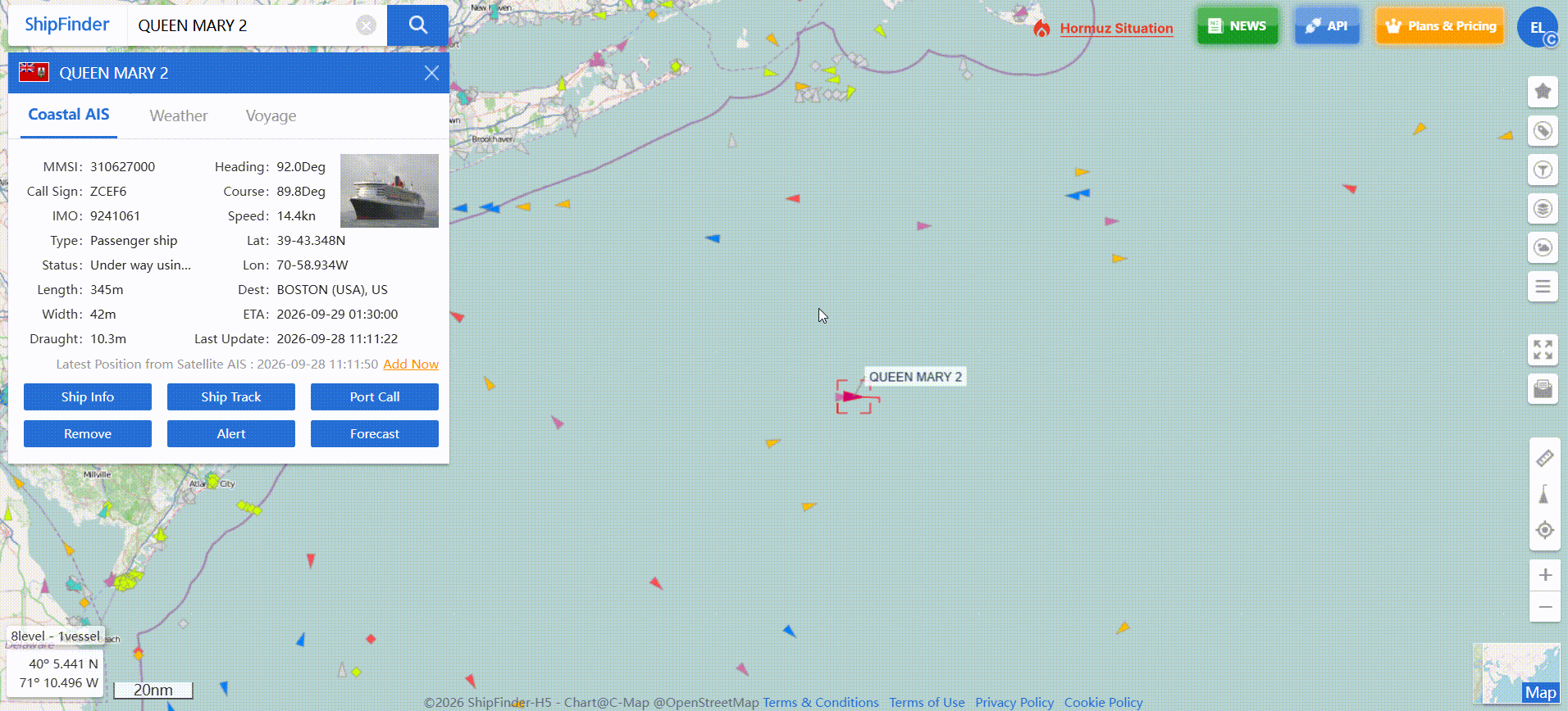
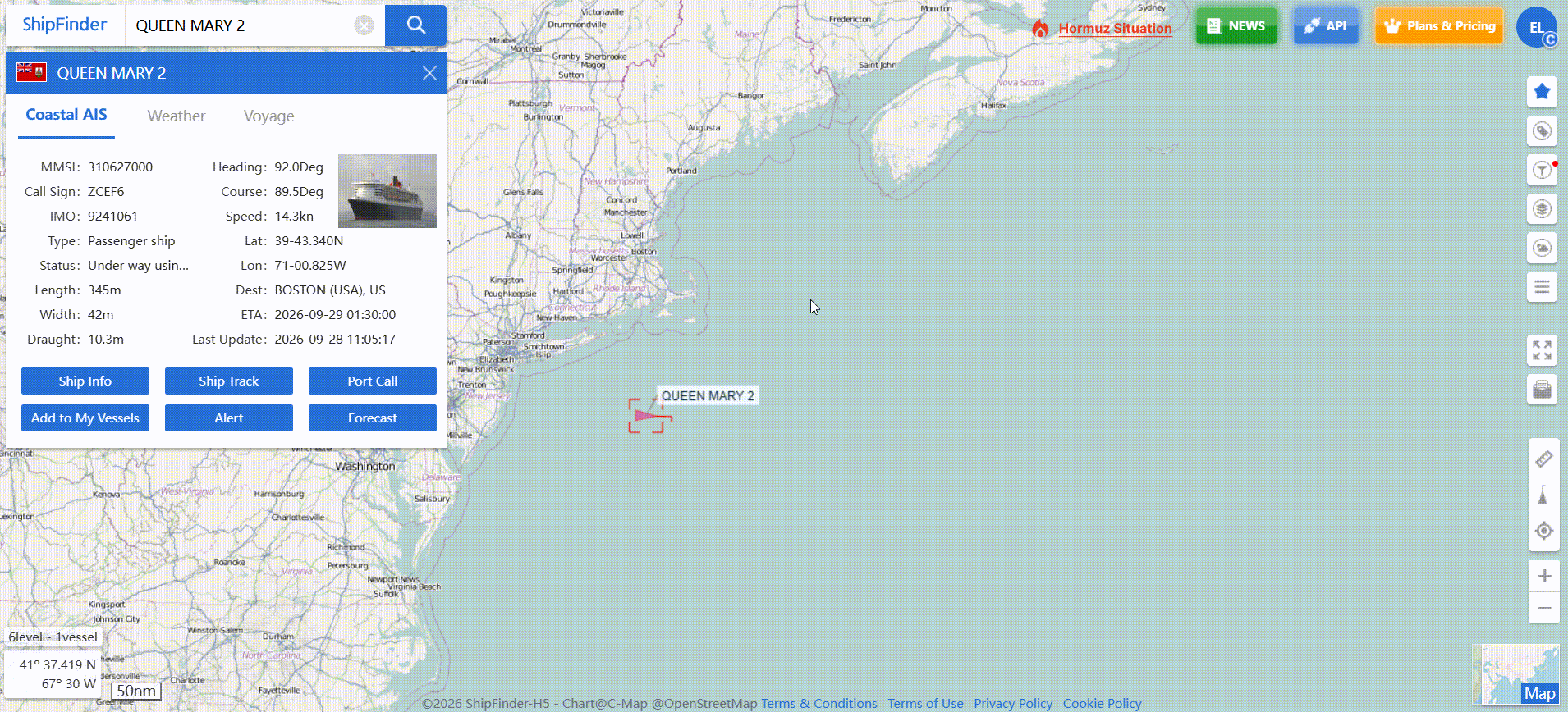
ShipFinder uses both terrestrial and satellite AIS. Shore-based receivers support tracking within coastal coverage, while satellite reception provides position reports from vessels sailing farther offshore.
Using both sources helps you follow voyages as ships move between coastal waters and offshore routes. The latest position available will depend on reception, data availability and your account's tracking access.
Enable Satellite Tracking for Your Vessel
To receive satellite updates, check that your account has an available satellite tracking slot, then add the vessel to satellite tracking. If satellite tracking is not enabled for that ship, your account may continue to show its last terrestrial AIS position while it is offshore.
The free Basic plan includes satellite AIS tracking for one designated vessel. Standard supports five vessels, while Professional offers unlimited satellite tracking. You can review these options in the ShipFinder plan comparison.
Review Historical Tracks and Port Calls
Historical information helps explain the movements leading up to a vessel's latest position. For example, you can check its most recent port departure and review the route recorded since then.
ShipFinder provides several ways to explore this information:
Historical tracks: View the vessel's recorded route over the available period.
Port calls: Check recorded port visits, including arrival and departure times.
Playback: Replay the vessel's recorded movements.
Route forecast: View the predicted onward route.
Historical tracks describe recorded activity; route forecasts estimate future movements. Keep that distinction in mind when reviewing a voyage.
The accessible historical period depends on your plan. Basic includes 3 days, Standard includes 14 days, and Professional includes 6 months.
Monitor Vessel Activity with Alerts and Fleet Management
Receive Updates on Relevant Vessel Events
For ongoing monitoring, set alerts around the events you need to follow. ShipFinder supports email notifications for activities including arrivals, departures, area entry or exit, and speed changes.
Choose the relevant events and configure your notification email address. Updates can then reach you without requiring you to keep the map open.
An alert provides a reason to check the vessel's activity. For example, a speed change may prompt you to review its position and recent movements before deciding whether any follow-up is needed.
Keep the Vessels You Follow Together
Add regularly monitored ships to a fleet so you can return to their positions and movements without repeating individual searches.
A shipowner might keep owned vessels together, while an operator or charterer might maintain a list for current voyages. Personal users can organize the ships they follow in the same way.
Start with Free Tracking
Open ShipFinder to search for a vessel and check its latest position. Create a free account to start monitoring the ships you follow.
FAQ
Can I search for a ship by name, IMO number or MMSI?
Yes. Enter any of these identifiers in ShipFinder's search bar and select the matching vessel. Check its IMO number or MMSI if several results have similar names.
Is ShipFinder free to use?
Yes. You can use ShipFinder to search for vessels and check their positions for free. A free account also gives you access to three days of historical tracks, fleet management for up to 10 vessels, and satellite AIS tracking for one designated vessel.
How current are the vessel positions shown on ShipFinder?
ShipFinder displays the latest available AIS reports. Their freshness depends on transmission, reception, data delivery and your account’s access. Check the displayed report timestamp to assess how recent a position is.
Can I track vessels while they are offshore?
Yes. Add the vessel to satellite tracking and confirm that your free account has an available slot. Satellite AIS provides offshore position updates beyond coastal receiver coverage.
Can I monitor several vessels at once?
Yes. Fleet management lets you organize multiple vessels for regular monitoring. The number of ships you can add to a fleet depends on your plan. The Basic Plan offers 10 vessels for fleet management.